

Published 4:30 pm Monday, October 26, 2026
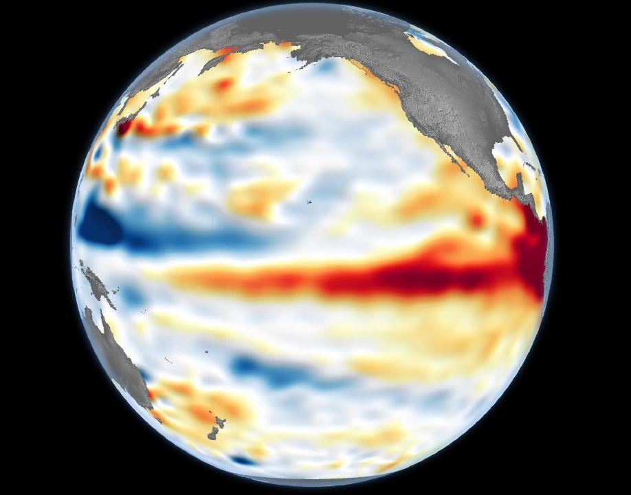
This image taken by NASA Earth Observatory on June 8 shows the band of warm water along the equator that triggered what may become the strongest El Niño since record-keeping began in 1950.
(NASA/contributed)
| Getting your Trinity Audio player ready… |
The El Niño forming in the mid-Pacific already is venturing into record-setting territory, and climate forecasting models suggest it will get stronger for several more months.
The ocean has been warming since April, and the National Weather Service reported Oct. 26 that sea-surface temperatures were 2.5 degrees Celsius above average over 2.4 million square miles along the equator.
If the temperature is sustained, this El Niño will top the record 2.3 degrees above average set between November 2015 and January 2016. Record keeping began in 1950.
Some climate models project temperatures will top 3.5 degrees above normal, according to Columbia University’s climate research institute. All 27 models predicted a “very strong” El Niño in which sea-surface temperatures are at least 2 degrees above normal.
“We’re in good shape to at least challenge the record, if not break it,” Oregon State Climatologist Larry O’Neill said.
El Niños are rated by sea-surface temperatures, not actual impacts. Still, a very strong El Nino tilts the odds in favor of above-normal winter temperatures in Washington, Oregon, Idaho and California.
El Niño shifts storms to the south, so meteorologists predict big snowpacks in Northern California.
PNW impacts a tossup
In mid-October, the weather service’s Climate Prediction Center said it was a tossup whether most of Oregon, Washington and Idaho would have more or less precipitation than normal.
Warm temperatures and low rain and snow totals would portend water shortages during the 2027 irrigation season.
In the past week, however, the climate center predicted that all three states, as well as California, will have at least a wet November. The center will update its outlook for December and January on Nov. 19.
South America’s coastal waters last week were a record 4.4 degrees Celsius above average. The Northwest has been historically wet when the ocean there is especially warm during an El Niño, O’Neill said.
“We do know it will be an Eastern Pacific El Nino,” he said. “Right now, it’s on the table. It could be a wet, very strong El Niño.”
Climate forecast models have accurately predicted El Niño’s growing force, but they could be wrong about the future, O’Neill said. “Now, we’re in kind of uncharted territory,” he said.
The El Niño already broke one record. Sea-surface temperatures averaged 1.7 degrees above normal in July, August and September. The old record for that period was 1.5 degrees set in 2015.
